


Weather radar guide
PocketRadarHow to read weather radar in five practical steps.
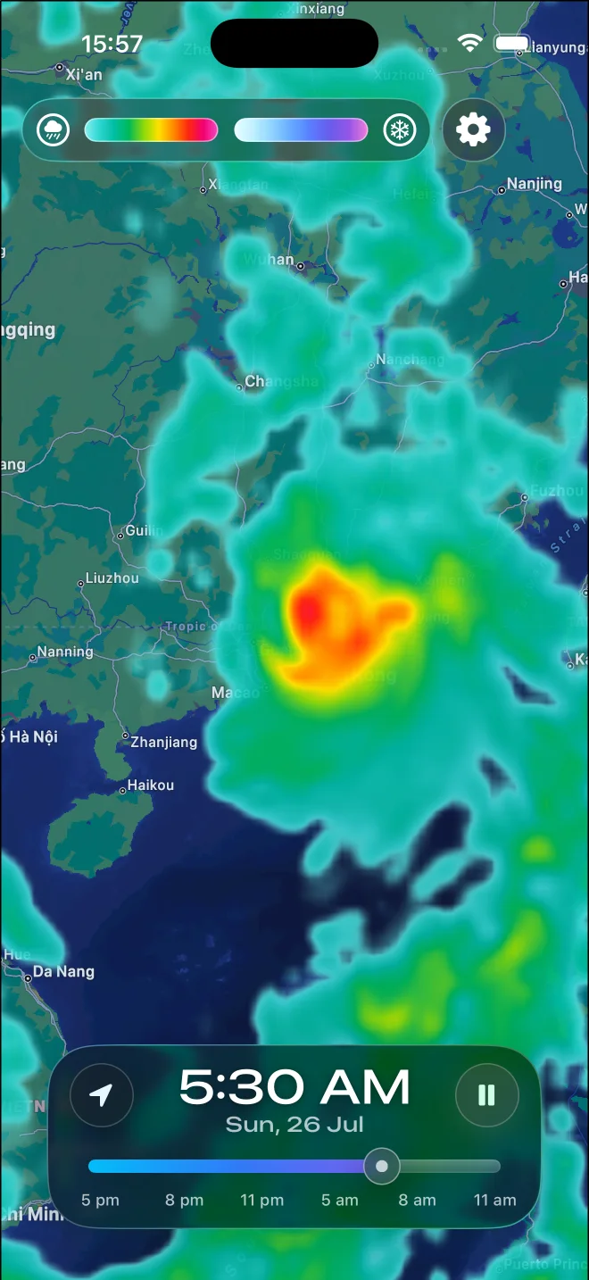
Check the timestamp and your location first. Then play the loop to follow movement, compare intensity with the map legend, watch how echoes change, and confirm important decisions with current observations and official alerts.
The short answer
To read a weather radar map, find your location and the latest timestamp, play several recent frames, and track the same precipitation area from frame to frame. Use the legend to compare weaker and stronger echoes, but treat radar as evidence of what is reflecting energy in the atmosphere—not a guarantee of exactly what is reaching the ground.
Check the timestamp and find your location.
A radar image is only useful when you know when it was captured. Start with the latest time shown on the map, then locate your position and note where precipitation sits relative to it. If the final frame is old, do not assume the echoes still occupy the same place.
Play several frames instead of trusting one image.
A single frame shows position. A loop shows motion. Follow the same recognizable edge, band, or compact area through multiple frames to see whether it is approaching, moving away, weakening, growing, or changing direction.
The National Weather Service recommends checking the beginning and ending times of the loop before making a first estimate of storm movement.
Read intensity against the map's own legend.
Radar reflectivity describes the strength of energy returned to the radar. Stronger returns often accompany heavier precipitation, but colors vary between products and palettes, so the legend—not the color name—is the source of truth.
As a reference for U.S. WSR-88D displays, the National Weather Service notes that light rain often begins around 20 dBZ and values of 50 dBZ or more are commonly associated with heavy thunderstorms and sometimes hail. These are clues, not reliable thresholds for proving hail or severe weather.
Follow shape and trend, not just the brightest pixel.
Watch whether an echo maintains a coherent shape and direction across the loop. A broad moving band suggests a different short-term situation from a small shower that appears and fades between scans. Brightening can indicate a stronger return, but it does not by itself reveal the exact precipitation type at the ground.
Confirm important decisions with another source.
Compare the radar with what you can observe, a current forecast, and official warnings. Radar is excellent for short-term precipitation context, but it is not a substitute for emergency alerts, local instructions, or a detailed forecast when safety matters.
Common patterns and what to check next
These are practical clues, not automatic diagnoses.
| What you see | What it may mean | What to check |
|---|---|---|
| A coherent area moving across several frames | Organized precipitation motion | Track its leading and trailing edges relative to your location |
| An echo growing stronger or broader | Increasing reflectivity or expanding coverage | Compare multiple frames and the map legend |
| Speckled returns that remain fixed near a radar site | Possible ground clutter or anomalous propagation | Check whether the pattern moves and compare nearby observations |
| Radar echoes overhead but dry conditions at the surface | Possible virga or precipitation sampled above the ground | Check surface observations and the low-level forecast |
Why radar and the weather outside can disagree
Weather radar samples a volume of the atmosphere. It does not directly measure every drop at ground level. Dry air can evaporate falling precipitation before it reaches the surface; this is called virga. Read the detailed guide to why radar can show rain when it is dry outside.
Distance also matters. The radar beam rises and broadens as it travels, while Earth's curvature places it progressively higher above the surface. Far from a radar, shallow precipitation may be undersampled or missed.
Not every echo is precipitation
Buildings, terrain, insects, birds, wind turbines, and unusual atmospheric refraction can create non-weather returns. Stationary, speckled, or inconsistent shapes deserve a second check. For intensity, compare the display with its legend using the weather radar color guide.
Put the method into practice
Read movement in PocketRadar.
Open the map, return to your location, and play the precipitation timeline. Follow the same edge through several frames, pause on the latest image, and switch palettes when another color scale is easier to distinguish.
PocketRadar includes animated rain and snow, location controls, three map styles, four radar palettes, Home Screen widgets, and an Apple Watch app.